Demonstration extract · the first pages of a City Twin report Open the public demonstration Request access
City Twin - the city explained through data
DEMONSTRATION EXTRACT · Brașov public data

A snapshot of the city

Municipality of Brașov · 237,000 residents

Generated by City Twin on 2 August 2026, from the Brașov model version 0.2.0 (the snapshot of that day), based on official documents and other public sources (PUG (General Urban Plan), PMUD/SUMP (Sustainable Urban Mobility Plan), SIDU (Integrated Urban Development Strategy), PAED (Sustainable Energy Action Plan), local budget, OpenStreetMap, Open-Meteo, Copernicus), with estimates marked · the report includes the sources it relies on · model coverage, that is the share of items linked to sources: 68%

What this document is. An extract from a City Twin report, just enough to show its form: a few indicators with their period and source, one source and one declared limitation. The full report (the documented problems, the projects that address them, the targets, all sources and the methodology) is generated in the partner institution's workspace, on its own data, and is checked before use. The figures below come from Brașov's public documents; estimated ones are marked with "~". This document is not issued or validated by the Municipality of Brașov.

1. The overall picture

Key indicators, each with its period and source.
237,000
resident population
order of magnitude from the 2021 census · population by registered residence, a different definition, is 288,493 (National Institute of Statistics, 2021)
402,000
trips / day
PMUD 2015 · baseline value
~4.2 m²
green space / resident, central area
estimate for the central neighbourhoods in the model, with green spaces mapped in OpenStreetMap; not a municipality-wide indicator
34.8 °C
maximum air temperature (summer 2025)
Open-Meteo / ERA5 reanalysis, for the city's reference point; a modelled product, not a station measurement
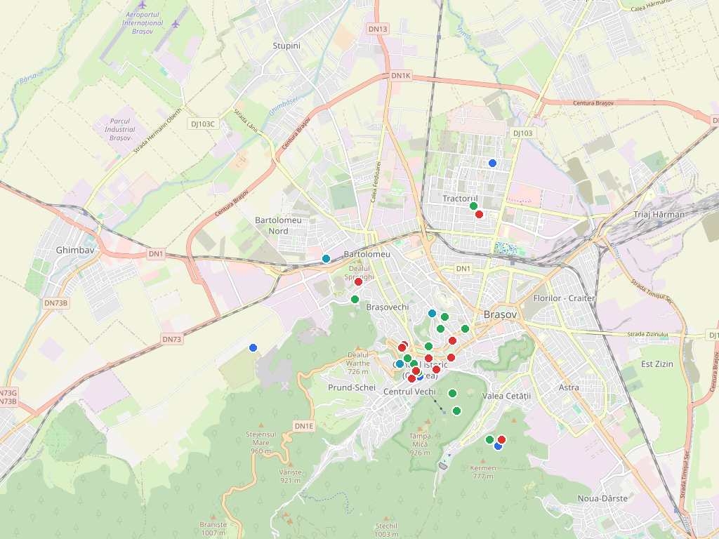
Map of Brașov with the areas, projects, services, problems and indicators from the model, over an OpenStreetMap base
The items in the model that can be located, placed on the map (OpenStreetMap base, faded for legibility). The screenshot is from an earlier version of the model; the number of items grows with every extension, and the figures in the text are those of the 2 August 2026 snapshot. areas projects services problems indicators

2. The source of this page

Every figure in the report carries its source. For the indicators above, the main one:

· PMUD / SUMP - Sustainable Urban Mobility Plan of the Brașov Metropolitan Area, 2015 baseline values

The full report cites all the model's sources, and in the application every answer shows exactly which one it comes from.

3. One declared limitation

Traffic volumes are estimated from the street hierarchy, not from counts made on the ground. City Twin does not invent what it does not have: it declares the gap, next to the figure. The full report lists all the model's gaps and its coverage.

What the full report contains

For partner institutions, on their own city's data: the distribution of trips, the documented problems with their severity, the projects that address them and the status of each, the targets against which progress is measured, the full list of sources, the methodology and the model's declared coverage. The document is generated in the institution's workspace and carries its identifiers and the user who issued it.

▶ Open the public demonstration

Identification of this extract: report CT-DEMO-BV-0001 · Brașov model version 0.2.0 · snapshot 2 August 2026 · generated by City Twin (ARSC). Reports issued in an institution's workspace carry the same set of identifiers, plus the user who generated them. The platform interface is currently in Romanian.

The Smart City Romania network run by ARSC

Discover the projects, investments and opportunities in Romania's smart city ecosystem. The sites below are in Romanian.

arsc.ro · [email protected]